
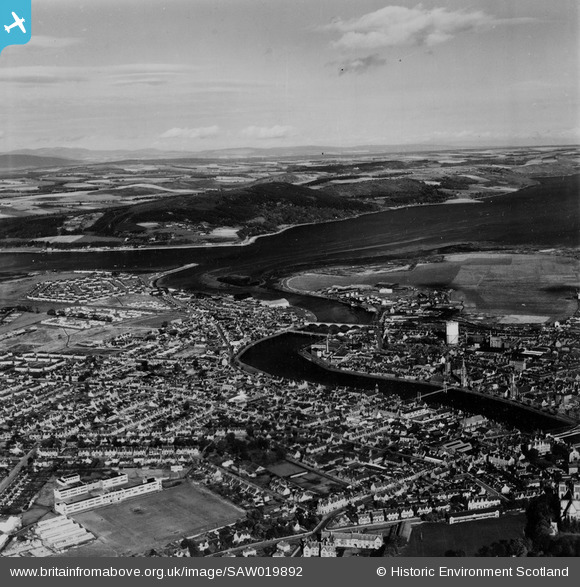
SAW019892 SCOTLAND (1948). Inverness and Moray Firth, general view. An oblique aerial photograph taken facing north. This image has been produced from a print.
© Copyright OpenStreetMap contributors and licensed by the OpenStreetMap Foundation. 2026. Cartography is licensed as CC BY-SA.
Nearby Images (3)
SAW019892

SPW033830

SAW019891

Details
| Title | [SAW019892] Inverness and Moray Firth, general view. An oblique aerial photograph taken facing north. This image has been produced from a print. |
| Reference | SAW019892 |
| Date | 1948 |
| Link | NRHE Collection item 1315149 |
| Place name | |
| Parish | INVERNESS AND BONA |
| District | INVERNESS |
| Country | SCOTLAND |
| Easting / Northing | 266186, 845682 |
| Longitude / Latitude | -4.2321523922086, 57.481821871166 |
| National Grid Reference | NH662457 |
Pins

The Local Historian |
Saturday 7th of February 2026 12:42:08 PM | |
|
The Local Historian |
Saturday 7th of February 2026 12:36:49 PM | |
|
The Local Historian |
Saturday 7th of February 2026 12:29:29 PM | |
|
The Local Historian |
Saturday 7th of February 2026 12:27:26 PM | |
|
The Local Historian |
Wednesday 27th of July 2022 08:21:53 PM | |
|
redmist |
Sunday 31st of January 2021 10:47:53 AM | |
|
redmist |
Sunday 31st of January 2021 10:46:54 AM | |

Matt Aldred edob.mattaldred.com |
Tuesday 8th of December 2020 08:43:14 PM | |
|
Matt Aldred edob.mattaldred.com |
Tuesday 8th of December 2020 08:40:31 PM | |
|
Matt Aldred edob.mattaldred.com |
Tuesday 8th of December 2020 08:37:15 PM | |
|
Matt Aldred edob.mattaldred.com |
Tuesday 8th of December 2020 08:35:49 PM | |

Billy Turner |
Saturday 11th of May 2019 08:31:53 PM | |
Grant Street park - home of Clach. |
The Local Historian |
Saturday 7th of February 2026 12:43:25 PM |