
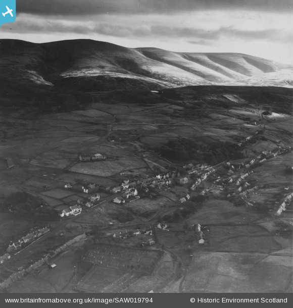
SAW019794 SCOTLAND (1948). Leadhills and Lowther Hills. An oblique aerial photograph taken facing south. This image has been produced from a print.
© Copyright OpenStreetMap contributors and licensed by the OpenStreetMap Foundation. 2026. Cartography is licensed as CC BY-SA.
Nearby Images (3)
SAW019794

SAW019796

SAW019795

Details
| Title | [SAW019794] Leadhills and Lowther Hills. An oblique aerial photograph taken facing south. This image has been produced from a print. |
| Reference | SAW019794 |
| Date | 1948 |
| Link | NRHE Collection item 1315095 |
| Place name | |
| Parish | CRAWFORD |
| District | CLYDESDALE |
| Country | SCOTLAND |
| Easting / Northing | 288656, 614885 |
| Longitude / Latitude | -3.7590826345384, 55.415195495972 |
| National Grid Reference | NS887149 |
Pins

Ken |
Monday 6th of October 2014 05:11:08 PM | |
|
Tam |
Wednesday 7th of August 2013 09:03:55 AM | |
|
Tam |
Wednesday 7th of August 2013 09:03:08 AM | |
|
Tam |
Wednesday 7th of August 2013 09:02:30 AM | |
|
Tam |
Wednesday 7th of August 2013 09:02:01 AM |
User Comment Contributions

Leadhills is the second highest village in Scotland after nearby Wanlockhead. It owes its location to the rich lead deposits which were mined on an industrial scale from the 17th century. When in 1735 the mines ceased to be profitable, the Scots Mining Company appointed James Stirling as a Manager. He began to radically reform the working and living conditions of the mining families, securing for any miner the right to land for houses and plots of ground or ‘yards’ for cultivation. The cottages and gardens scattered around the hillside in Leadhills are a modern reminder of how land tenure has influenced the pattern of development in the village. The main building type at Leadhills is the single or one-and-a-half storey cottage row. This traditional ‘basic cottage’ design includes low eaves, and a single door with windows to either side. The front entrance door is usually positioned off-centre within the front elevation to the property. (Information from South Lanarkshire Council, Leadhills Conservation Area Appraisal and Management Plan: consult.southlanarkshire.gov.uk/file/253305) |
Brian Wilkinson |
Tuesday 17th of September 2013 12:50:44 PM |