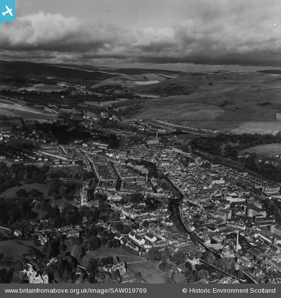
SAW019769 SCOTLAND (1948). Galashiels, general view, showing Cornmill Square and Glendinning Terrace. An oblique aerial photograph taken facing north. This image has been produced from a print.
© Copyright OpenStreetMap contributors and licensed by the OpenStreetMap Foundation. 2026. Cartography is licensed as CC BY-SA.
Nearby Images (2)
SAW019769

SAW019770

Details
| Title | [SAW019769] Galashiels, general view, showing Cornmill Square and Glendinning Terrace. An oblique aerial photograph taken facing north. This image has been produced from a print. |
| Reference | SAW019769 |
| Date | 1948 |
| Link | NRHE Collection item 1315079 |
| Place name | |
| Parish | GALASHIELS |
| District | ETTRICK AND LAUDERDALE |
| Country | SCOTLAND |
| Easting / Northing | 348797, 636607 |
| Longitude / Latitude | -2.8131209458528, 55.620351777734 |
| National Grid Reference | NT488366 |
Pins

Class31 |
Tuesday 6th of May 2014 07:06:40 PM |