
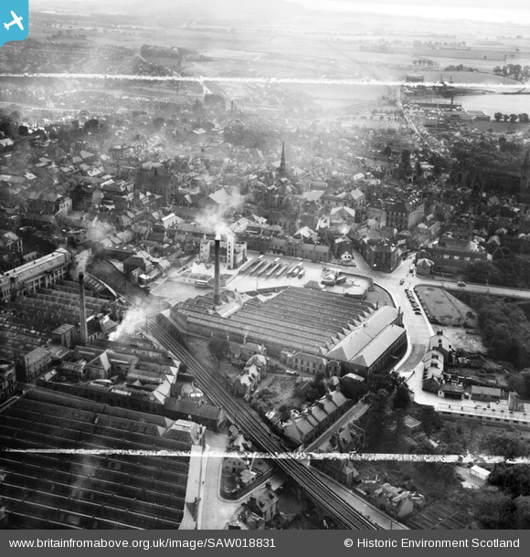
SAW018831 SCOTLAND (1948). Dunfermline, general view, showing Winterthur Silks Ltd. Canmore Works, Bruce Street and Carnegie Drive. An oblique aerial photograph taken facing south. This image has been produced from a crop marked negative.
© Copyright OpenStreetMap contributors and licensed by the OpenStreetMap Foundation. 2026. Cartography is licensed as CC BY-SA.
Nearby Images (12)
SAW018831

SAW018827

SAW018830

SAW018832

SAW018829

SAW018833

SAW018828

SAW018834

SAW018836

SAW018835

SAW018837

SPW040404

Details
| Title | [SAW018831] Dunfermline, general view, showing Winterthur Silks Ltd. Canmore Works, Bruce Street and Carnegie Drive. An oblique aerial photograph taken facing south. This image has been produced from a crop marked negative. |
| Reference | SAW018831 |
| Date | 1948 |
| Link | NRHE Collection item 1269126 |
| Place name | |
| Parish | DUNFERMLINE |
| District | DUNFERMLINE |
| Country | SCOTLAND |
| Easting / Northing | 309062, 687665 |
| Longitude / Latitude | -3.4610556148512, 56.073206215418 |
| National Grid Reference | NT091877 |
Pins
Be the first to add a comment to this image!