
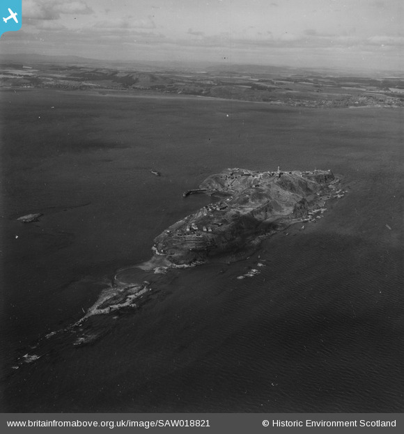
SAW018821 SCOTLAND (1948). Inchkeith, Firth of Forth. An oblique aerial photograph taken facing north-west. This image has been produced from a print.
© Copyright OpenStreetMap contributors and licensed by the OpenStreetMap Foundation. 2026. Cartography is licensed as CC BY-SA.
Nearby Images (2)
SAW018821

SAW018820

Details
| Title | [SAW018821] Inchkeith, Firth of Forth. An oblique aerial photograph taken facing north-west. This image has been produced from a print. |
| Reference | SAW018821 |
| Date | 1948 |
| Link | NRHE Collection item 1314871 |
| Place name | |
| Parish | KINGHORN |
| District | KIRKCALDY |
| Country | SCOTLAND |
| Easting / Northing | 329413, 682512 |
| Longitude / Latitude | -3.1328108869445, 56.030348324784 |
| National Grid Reference | NT294825 |
Pins

redmist |
Monday 10th of October 2022 12:16:34 PM | |
|
redmist |
Monday 10th of October 2022 12:15:39 PM | |
|
redmist |
Monday 10th of October 2022 12:14:05 PM | |
|
redmist |
Monday 10th of October 2022 12:12:33 PM | |
|
redmist |
Monday 10th of October 2022 12:12:02 PM | |
|
redmist |
Monday 10th of October 2022 12:10:51 PM | |
|
redmist |
Monday 10th of October 2022 12:04:42 PM | |
|
redmist |
Monday 10th of October 2022 11:58:01 AM | |
|
redmist |
Monday 10th of October 2022 11:57:25 AM | |
|
redmist |
Monday 10th of October 2022 11:57:01 AM | |
|
redmist |
Monday 10th of October 2022 11:56:32 AM | |
|
redmist |
Monday 10th of October 2022 11:55:12 AM | |
|
redmist |
Monday 10th of October 2022 11:52:03 AM | |
|
redmist |
Monday 10th of October 2022 11:49:27 AM | |
|
redmist |
Monday 10th of October 2022 11:42:50 AM | |
|
Norman |
Tuesday 12th of January 2016 01:59:56 PM | |
|
Norman |
Tuesday 12th of January 2016 01:58:57 PM | |
|
Norman |
Tuesday 12th of January 2016 01:54:24 PM |
User Comment Contributions

Whole island is covered in defences |

JMB |
Saturday 3rd of May 2014 10:30:13 PM |