
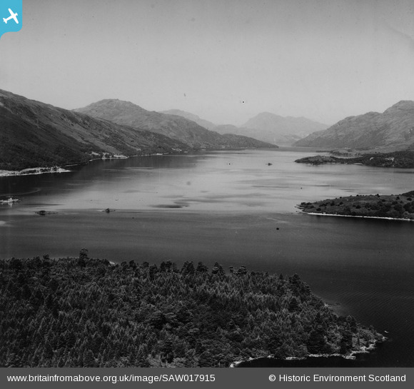
SAW017915 SCOTLAND (1948). Loch Lomond, general view, showing Inchconnachan and Ross Point. An oblique aerial photograph taken facing north. This image has been produced from a print.
© Copyright OpenStreetMap contributors and licensed by the OpenStreetMap Foundation. 2026. Cartography is licensed as CC BY-SA.
Nearby Images (2)
SAW017913

SAW017915

Details
| Title | [SAW017915] Loch Lomond, general view, showing Inchconnachan and Ross Point. An oblique aerial photograph taken facing north. This image has been produced from a print. |
| Reference | SAW017915 |
| Date | 1948 |
| Link | NRHE Collection item 1314828 |
| Place name | |
| Parish | LUSS |
| District | DUMBARTON |
| Country | SCOTLAND |
| Easting / Northing | 237560, 692960 |
| Longitude / Latitude | -4.6120122304389, 56.101807083577 |
| National Grid Reference | NS376930 |
Pins

Billy Turner |
Tuesday 10th of December 2019 02:24:14 PM |
