
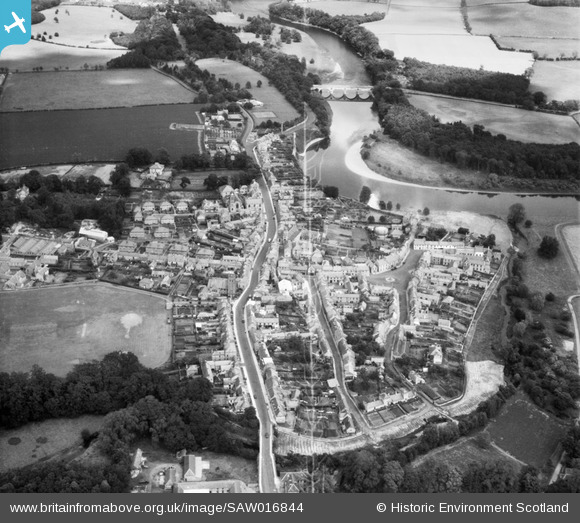
SAW016844 SCOTLAND (1948). Coldstream, general view, showing High Street and Coldstream Bridge. An oblique aerial photograph taken facing north-east.
© Copyright OpenStreetMap contributors and licensed by the OpenStreetMap Foundation. 2025. Cartography is licensed as CC BY-SA.
Nearby Images (12)
SAW016844

SAR020374

SAR020767

SAR035966

SAR035967

SAR036308

SAW016845

SAW032035

SAW032034

SAW032033

SAW032032

SAW016846

Details
| Title | [SAW016844] Coldstream, general view, showing High Street and Coldstream Bridge. An oblique aerial photograph taken facing north-east. |
| Reference | SAW016844 |
| Date | 1948 |
| Link | Canmore Collection item 1269056 |
| Place name | |
| Parish | COLDSTREAM |
| District | BERWICKSHIRE |
| Country | SCOTLAND |
| Easting / Northing | 384226, 639762 |
| Longitude / Latitude | -2.2506902188902, 55.651142159937 |
| National Grid Reference | NT842398 |
Pins
 J May |
Monday 24th of February 2025 03:40:11 PM | |
J May |
Monday 24th of February 2025 03:39:53 PM | |
J May |
Monday 24th of February 2025 03:38:14 PM | |
 Class31 |
Thursday 22nd of November 2012 06:05:56 PM | |
Class31 |
Thursday 22nd of November 2012 06:05:02 PM | |
Class31 |
Thursday 22nd of November 2012 06:04:09 PM | |
Class31 |
Thursday 22nd of November 2012 06:03:40 PM | |
Class31 |
Thursday 22nd of November 2012 06:03:09 PM | |
Class31 |
Thursday 22nd of November 2012 06:02:50 PM | |
Class31 |
Thursday 22nd of November 2012 06:01:26 PM | |
Class31 |
Thursday 22nd of November 2012 06:00:19 PM |