
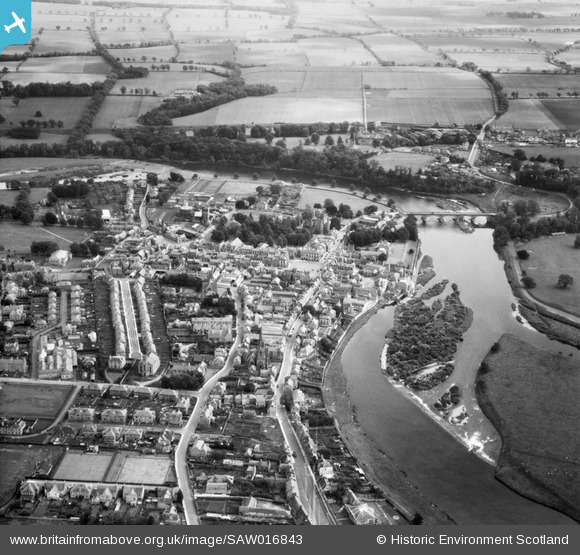
SAW016843 SCOTLAND (1948). Kelso, general view, showing Kelso Bridge and Roxburgh Street. An oblique aerial photograph taken facing south-east.
© Copyright OpenStreetMap contributors and licensed by the OpenStreetMap Foundation. 2026. Cartography is licensed as CC BY-SA.
Nearby Images (10)
SAW016843

SAR035975

SAW016841

SAW016842

SAW016840

SPW042178

SPW042182

SPW042179

SPW042181

SPW042180

Details
| Title | [SAW016843] Kelso, general view, showing Kelso Bridge and Roxburgh Street. An oblique aerial photograph taken facing south-east. |
| Reference | SAW016843 |
| Date | 1948 |
| Link | NRHE Collection item 1269055 |
| Place name | |
| Parish | KELSO |
| District | ROXBURGH |
| Country | SCOTLAND |
| Easting / Northing | 372732, 633998 |
| Longitude / Latitude | -2.4327843066248, 55.598837575003 |
| National Grid Reference | NT727340 |
Pins
Be the first to add a comment to this image!
User Comment Contributions
all pictures of Kelso im speechless,moved deeplyi look forward to more thankyou |

Learning2Fly |
Tuesday 3rd of May 2016 03:45:08 AM |