
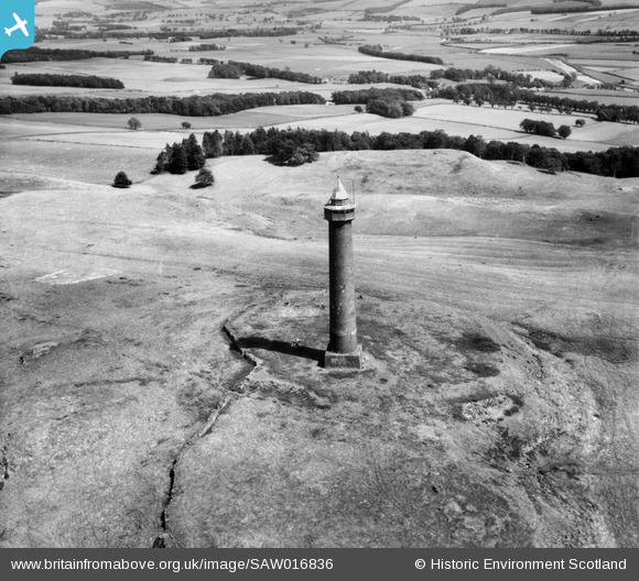
SAW016836 SCOTLAND (1948). Waterloo Monument, Peniel Heugh. An oblique aerial photograph taken facing east.
© Copyright OpenStreetMap contributors and licensed by the OpenStreetMap Foundation. 2025. Cartography is licensed as CC BY-SA.
Nearby Images (2)
SAW016836

SAW016837

Details
| Title | [SAW016836] Waterloo Monument, Peniel Heugh. An oblique aerial photograph taken facing east. |
| Reference | SAW016836 |
| Date | 1948 |
| Link | NRHE Collection item 1269048 |
| Place name | |
| Parish | CRAILING |
| District | ROXBURGH |
| Country | SCOTLAND |
| Easting / Northing | 365367, 626304 |
| Longitude / Latitude | -2.5487080829279, 55.529231306612 |
| National Grid Reference | NT654263 |
Pins
User Comment Contributions
The Waterloo Monument is a 150' tower built between 1817 and 1824 to commemorate the Battle of Waterloo. It was designed by the architect Archibald Elliot. |

Class31 |
Thursday 22nd of November 2012 11:25:36 AM |