
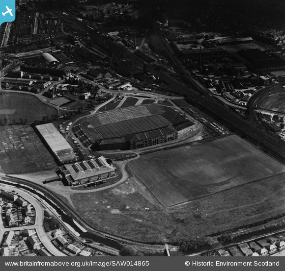
SAW014865 SCOTLAND (1948). Murrayfield Rugby Football Ground, Roseburn Street, Edinburgh. An oblique aerial photograph taken facing east. This image has been produced from a print.
© Copyright OpenStreetMap contributors and licensed by the OpenStreetMap Foundation. 2026. Cartography is licensed as CC BY-SA.
Nearby Images (4)
SAR008694

SAW014865

SPW027315

SPW027316

Details
| Title | [SAW014865] Murrayfield Rugby Football Ground, Roseburn Street, Edinburgh. An oblique aerial photograph taken facing east. This image has been produced from a print. |
| Reference | SAW014865 |
| Date | 1948 |
| Link | NRHE Collection item 1314764 |
| Place name | |
| Parish | EDINBURGH (EDINBURGH, CITY OF) |
| District | CITY OF EDINBURGH |
| Country | SCOTLAND |
| Easting / Northing | 322590, 672830 |
| Longitude / Latitude | -3.2394957658068, 55.942314750214 |
| National Grid Reference | NT226728 |
Pins

rambler130 |
Saturday 26th of August 2023 05:53:24 PM | |

Billy Turner |
Friday 11th of September 2015 10:42:00 PM |

User Comment Contributions

Shows Edinburgh but located far away... |
Alan McFarlane |
Tuesday 21st of May 2013 02:32:14 PM |