
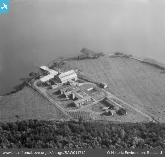
SAW011719 SCOTLAND (1947). Gibb Hill RAF Air Sea Rescue Base, Kirkcudbright. An oblique aerial photograph taken facing south-east.
© Copyright OpenStreetMap contributors and licensed by the OpenStreetMap Foundation. 2026. Cartography is licensed as CC BY-SA.
Nearby Images (6)
SAW011718

SAW011719

SAW011720

SAW011721

SAW011722

SAW011723

Details
| Title | [SAW011719] Gibb Hill RAF Air Sea Rescue Base, Kirkcudbright. An oblique aerial photograph taken facing south-east. |
| Reference | SAW011719 |
| Date | 1947 |
| Link | NRHE Collection item 1230978 |
| Place name | |
| Parish | TWYNHOLM |
| District | STEWARTRY |
| Country | SCOTLAND |
| Easting / Northing | 267170, 550480 |
| Longitude / Latitude | -4.0681796792644, 54.831417997601 |
| National Grid Reference | NX672505 |
Pins

redmist |
Thursday 1st of August 2019 10:28:43 PM |