
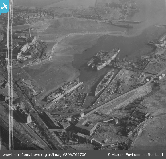
SAW011706 SCOTLAND (1947). Thomas Ward and Sons Shipbreaking Yard, Inverkeithing. An oblique aerial photograph taken facing north-east. This image has been produced from a crop marked print.
© Copyright OpenStreetMap contributors and licensed by the OpenStreetMap Foundation. 2026. Cartography is licensed as CC BY-SA.
Nearby Images (16)
SAW011706

SAW022471

SAW022476

SAW022472

SAW022478

SPW054713

SPW054715

SAW022477

SAW011707

SAW011708

SAW011709

SAW011710

SAW011711

SPW035664

SPW035668

SPW035670

Details
| Title | [SAW011706] Thomas Ward and Sons Shipbreaking Yard, Inverkeithing. An oblique aerial photograph taken facing north-east. This image has been produced from a crop marked print. |
| Reference | SAW011706 |
| Date | 1947 |
| Link | NRHE Collection item 1314705 |
| Place name | |
| Parish | INVERKEITHING |
| District | DUNFERMLINE |
| Country | SCOTLAND |
| Easting / Northing | 312760, 682100 |
| Longitude / Latitude | -3.3998503062698, 56.023904607297 |
| National Grid Reference | NT128821 |
Pins
Be the first to add a comment to this image!