
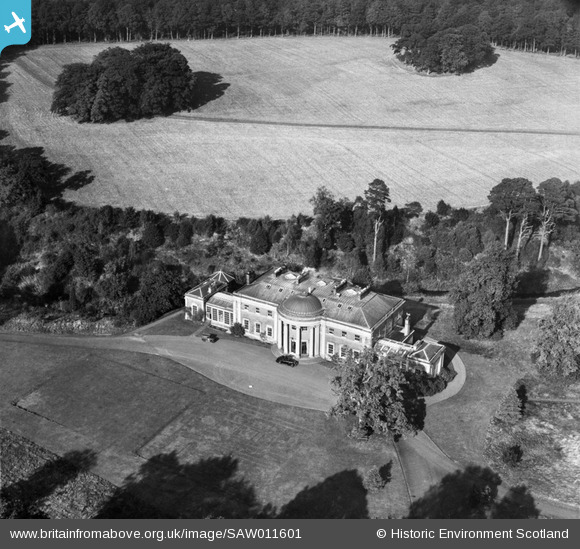
SAW011601 SCOTLAND (1947). Montgomerie House, Tarbolton. An oblique aerial photograph taken facing north.
© Copyright OpenStreetMap contributors and licensed by the OpenStreetMap Foundation. 2026. Cartography is licensed as CC BY-SA.
Nearby Images (6)
SAW011598

SAW011599

SAW011600

SAW011601

SAW011602

SAW011591

Details
| Title | [SAW011601] Montgomerie House, Tarbolton. An oblique aerial photograph taken facing north. |
| Reference | SAW011601 |
| Date | 1947 |
| Link | NRHE Collection item 1268819 |
| Place name | |
| Parish | TARBOLTON |
| District | KYLE AND CARRICK |
| Country | SCOTLAND |
| Easting / Northing | 244450, 626490 |
| Longitude / Latitude | -4.4633489179064, 55.507358680595 |
| National Grid Reference | NS445265 |
Pins

Billy Turner |
Tuesday 31st of May 2016 07:04:58 PM | |
|
Billy Turner |
Tuesday 31st of May 2016 06:00:45 PM |

