
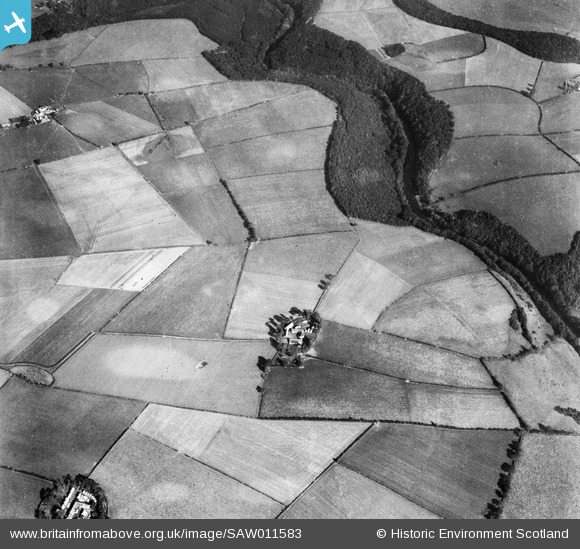
SAW011583 SCOTLAND (1947). Clune and Coilsholm Wood, Tarbolton. An oblique aerial photograph taken facing east.
© Copyright OpenStreetMap contributors and licensed by the OpenStreetMap Foundation. 2025. Cartography is licensed as CC BY-SA.
Nearby Images (2)
SAW011583

SAW011587

Details
| Title | [SAW011583] Clune and Coilsholm Wood, Tarbolton. An oblique aerial photograph taken facing east. |
| Reference | SAW011583 |
| Date | 1947 |
| Link | NRHE Collection item 1268801 |
| Place name | |
| Parish | TARBOLTON |
| District | KYLE AND CARRICK |
| Country | SCOTLAND |
| Easting / Northing | 244870, 624642 |
| Longitude / Latitude | -4.4556712194902, 55.490900452061 |
| National Grid Reference | NS449246 |
Pins
Be the first to add a comment to this image!