
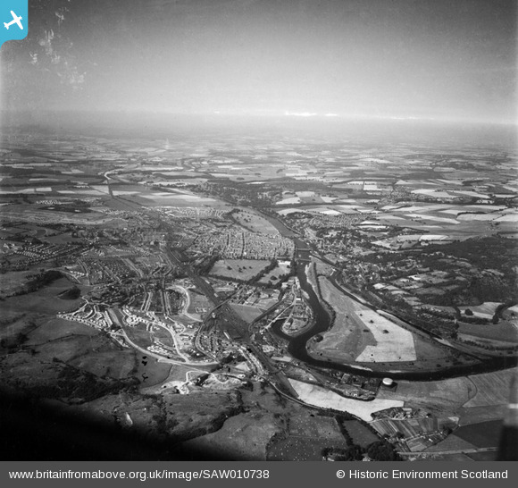
SAW010738 SCOTLAND (1947). Perth, general view, showing King James VI Golf Course and South Inch. An oblique aerial photograph taken facing north.
© Copyright OpenStreetMap contributors and licensed by the OpenStreetMap Foundation. 2026. Cartography is licensed as CC BY-SA.
Nearby Images (13)
SAW010738

SAW026585

SPW020089

SPW020090

SPW020091

SPW020092

SPW020093

SPW020094

SPW020095

SPW020104

SAW026584

SAR018932

SAR018933

Details
| Title | [SAW010738] Perth, general view, showing King James VI Golf Course and South Inch. An oblique aerial photograph taken facing north. |
| Reference | SAW010738 |
| Date | 1947 |
| Link | NRHE Collection item 1268730 |
| Place name | |
| Parish | PERTH |
| District | PERTH AND KINROSS |
| Country | SCOTLAND |
| Easting / Northing | 311810, 723903 |
| Longitude / Latitude | -3.428990455361, 56.399233279522 |
| National Grid Reference | NO118239 |
Pins
Be the first to add a comment to this image!