
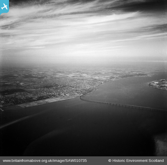
SAW010735 SCOTLAND (1947). Dundee, general view, showing Tay Bridge and Riverside Park. An oblique aerial photograph taken facing north-east.
© Copyright OpenStreetMap contributors and licensed by the OpenStreetMap Foundation. 2026. Cartography is licensed as CC BY-SA.
Nearby Images (2)
SAW010735

SPW040567

Details
| Title | [SAW010735] Dundee, general view, showing Tay Bridge and Riverside Park. An oblique aerial photograph taken facing north-east. |
| Reference | SAW010735 |
| Date | 1947 |
| Link | NRHE Collection item 1268727 |
| Place name | |
| Parish | DUNDEE (DUNDEE, CITY OF) |
| District | CITY OF DUNDEE |
| Country | SCOTLAND |
| Easting / Northing | 341440, 731620 |
| Longitude / Latitude | -2.9507016670654, 56.473163267585 |
| National Grid Reference | NO414316 |
Pins
Be the first to add a comment to this image!