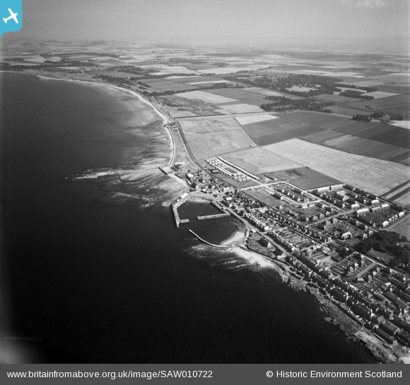
SAW010722 SCOTLAND (1947). Cockenzie and Port Seton, general view, showing Port Seton Harbour and Longniddry. An oblique aerial photograph taken facing east.
© Copyright OpenStreetMap contributors and licensed by the OpenStreetMap Foundation. 2026. Cartography is licensed as CC BY-SA.
Details
| Title | [SAW010722] Cockenzie and Port Seton, general view, showing Port Seton Harbour and Longniddry. An oblique aerial photograph taken facing east. |
| Reference | SAW010722 |
| Date | 1947 |
| Link | NRHE Collection item 1268715 |
| Place name | |
| Parish | TRANENT |
| District | EAST LOTHIAN |
| Country | SCOTLAND |
| Easting / Northing | 340700, 675900 |
| Longitude / Latitude | -2.9502440212786, 55.972472775749 |
| National Grid Reference | NT407759 |
Pins
User Comment Contributions

cptpies |
Thursday 19th of December 2013 03:13:14 PM |


![[SAW010722] Cockenzie and Port Seton, general view, showing Port Seton Harbour and Longniddry. An oblique aerial photograph taken facing east.](http://britainfromabove.org.uk/sites/all/libraries/aerofilms-images/public/100x100/SAW/010/SAW010722.jpg)
![[SPW047898] Aerodrome, Port Seton. An oblique aerial photograph taken facing south.](http://britainfromabove.org.uk/sites/all/libraries/aerofilms-images/public/100x100/SPW/047/SPW047898.jpg)
