
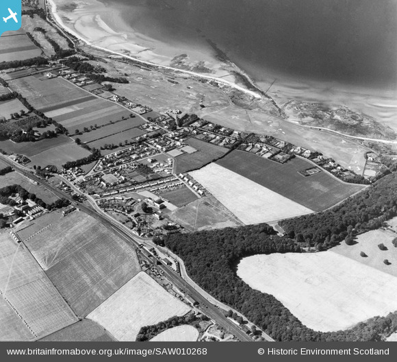
SAW010268 SCOTLAND (1947). Longniddry, general view, showing Longniddry Golf Course and Main Street. An oblique aerial photograph taken facing west.
© Copyright OpenStreetMap contributors and licensed by the OpenStreetMap Foundation. 2025. Cartography is licensed as CC BY-SA.
Nearby Images (2)
SAW010268

SAW010724

Details
| Title | [SAW010268] Longniddry, general view, showing Longniddry Golf Course and Main Street. An oblique aerial photograph taken facing west. |
| Reference | SAW010268 |
| Date | 1947 |
| Link | NRHE Collection item 1268702 |
| Place name | |
| Parish | GLADSMUIR |
| District | EAST LOTHIAN |
| Country | SCOTLAND |
| Easting / Northing | 344180, 676530 |
| Longitude / Latitude | -2.8946177995244, 55.978550316448 |
| National Grid Reference | NT442765 |
