
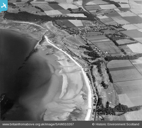
SAW010267 SCOTLAND (1947). Longniddry, general view, showing Longniddry Golf Course and Fernyness Wood. An oblique aerial photograph taken facing east.
© Copyright OpenStreetMap contributors and licensed by the OpenStreetMap Foundation. 2026. Cartography is licensed as CC BY-SA.
Details
| Title | [SAW010267] Longniddry, general view, showing Longniddry Golf Course and Fernyness Wood. An oblique aerial photograph taken facing east. |
| Reference | SAW010267 |
| Date | 1947 |
| Link | NRHE Collection item 1268701 |
| Place name | |
| Parish | GLADSMUIR |
| District | EAST LOTHIAN |
| Country | SCOTLAND |
| Easting / Northing | 342900, 676300 |
| Longitude / Latitude | -2.9150804429821, 55.976333301971 |
| National Grid Reference | NT429763 |
Pins
User Comment Contributions

unusual structure associated with wartime accommodation |

Al |
Tuesday 7th of January 2014 11:43:35 AM |