
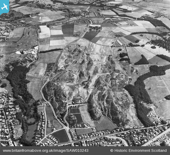
SAW010243 SCOTLAND (1947). Braid Hills Golf Course, Edinburgh. An oblique aerial photograph taken facing east.
© Copyright OpenStreetMap contributors and licensed by the OpenStreetMap Foundation. 2026. Cartography is licensed as CC BY-SA.
Details
| Title | [SAW010243] Braid Hills Golf Course, Edinburgh. An oblique aerial photograph taken facing east. |
| Reference | SAW010243 |
| Date | 1947 |
| Link | NRHE Collection item 1268677 |
| Place name | |
| Parish | EDINBURGH (EDINBURGH, CITY OF) |
| District | CITY OF EDINBURGH |
| Country | SCOTLAND |
| Easting / Northing | 325350, 669580 |
| Longitude / Latitude | -3.1944148903771, 55.913553626946 |
| National Grid Reference | NT254696 |
Pins

Andy A |
Wednesday 13th of July 2016 09:27:52 PM | |
|
Andy A |
Wednesday 13th of July 2016 09:26:24 PM | |
|
Al |
Wednesday 13th of July 2016 01:45:06 AM | |
|
Starcross |
Monday 11th of July 2016 04:18:08 AM | |
|
steviewatska |
Wednesday 27th of June 2012 11:51:27 PM |
User Comment Contributions
Liberton HAA battery |
Al |
Wednesday 13th of July 2016 01:46:04 AM |