
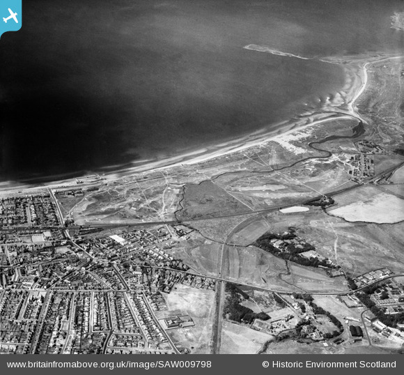
SAW009798 SCOTLAND (1947). Prestwick Golf Course, Links Road, Prestwick. An oblique aerial photograph taken facing west.
© Copyright OpenStreetMap contributors and licensed by the OpenStreetMap Foundation. 2026. Cartography is licensed as CC BY-SA.
Nearby Images (3)
SAW009797

SAW009798

SAW009799

Details
| Title | [SAW009798] Prestwick Golf Course, Links Road, Prestwick. An oblique aerial photograph taken facing west. |
| Reference | SAW009798 |
| Date | 1947 |
| Link | NRHE Collection item 1268643 |
| Place name | |
| Parish | MONKTON AND PRESTWICK |
| District | KYLE AND CARRICK |
| Country | SCOTLAND |
| Easting / Northing | 234728, 627099 |
| Longitude / Latitude | -4.6174985703719, 55.509634341581 |
| National Grid Reference | NS347271 |
Pins

John Llewellyn |
Sunday 27th of November 2016 08:23:01 PM | |
|
aj |
Thursday 9th of October 2014 05:50:44 PM | |
|
aj |
Thursday 9th of October 2014 05:44:08 PM | |
|
aj |
Thursday 9th of October 2014 05:41:15 PM | |
|
aj |
Thursday 9th of October 2014 05:37:30 PM |