
SAW003585 SCOTLAND (1947) [Unlocated]. Skiddaw, Lake District. Oblique aerial photograph.

© Copyright OpenStreetMap contributors and licensed by the OpenStreetMap Foundation. 2026. Cartography is licensed as CC BY-SA.
Nearby Images (48)
EPW000143

EPW000667

EPW005260

EPW006389
, 1921")
EPW007181

EPW015853

EPW015854

EPW015855

EPW016012

EPW016510

EPW016641

EPW017028

EPW017029

EPW017136

SAW003585

SAW003586

SAW009337

SAW009800

SAW009801

SAW009802

SAW010734

SAW014737

SAW017926

SAW017927

SAW032504

SPW020275

SPW020280

SPW020281

SPW020284

SPW020632

SPW020633

SPW027083

SPW049776

SPW049777

SPW049779

SPW049783

SPW049791

SPW049798

SPW049801

SPW049827

SPW049828

SPW049831

SPW049832

SPW049834

SPW049948

SPW049949

SPW051009

SPW062638

Details
| Title | [SAW003585] Skiddaw, Lake District. Oblique aerial photograph. |
| Reference | SAW003585 |
| Date | 1947 |
| Link | NRHE Collection item 1268501 |
| Place name | |
| Parish | |
| District | |
| Country | SCOTLAND |
| Easting / Northing | 0, 0 |
| Longitude / Latitude | -7.556448482059, 49.766185796754 |
| National Grid Reference | SV000000 |
Pins

Mike Holder |
Wednesday 14th of February 2018 12:06:24 PM | |
|
Mike Holder |
Wednesday 14th of February 2018 11:59:56 AM | |
|
Mike Holder |
Wednesday 14th of February 2018 11:54:29 AM | |
|
Mike Holder |
Wednesday 14th of February 2018 11:52:58 AM | |
|
Mike Holder |
Wednesday 14th of February 2018 11:52:12 AM | |
|
Mike Holder |
Wednesday 14th of February 2018 11:51:17 AM | |
|
Mike Holder |
Wednesday 14th of February 2018 11:50:46 AM |
User Comment Contributions
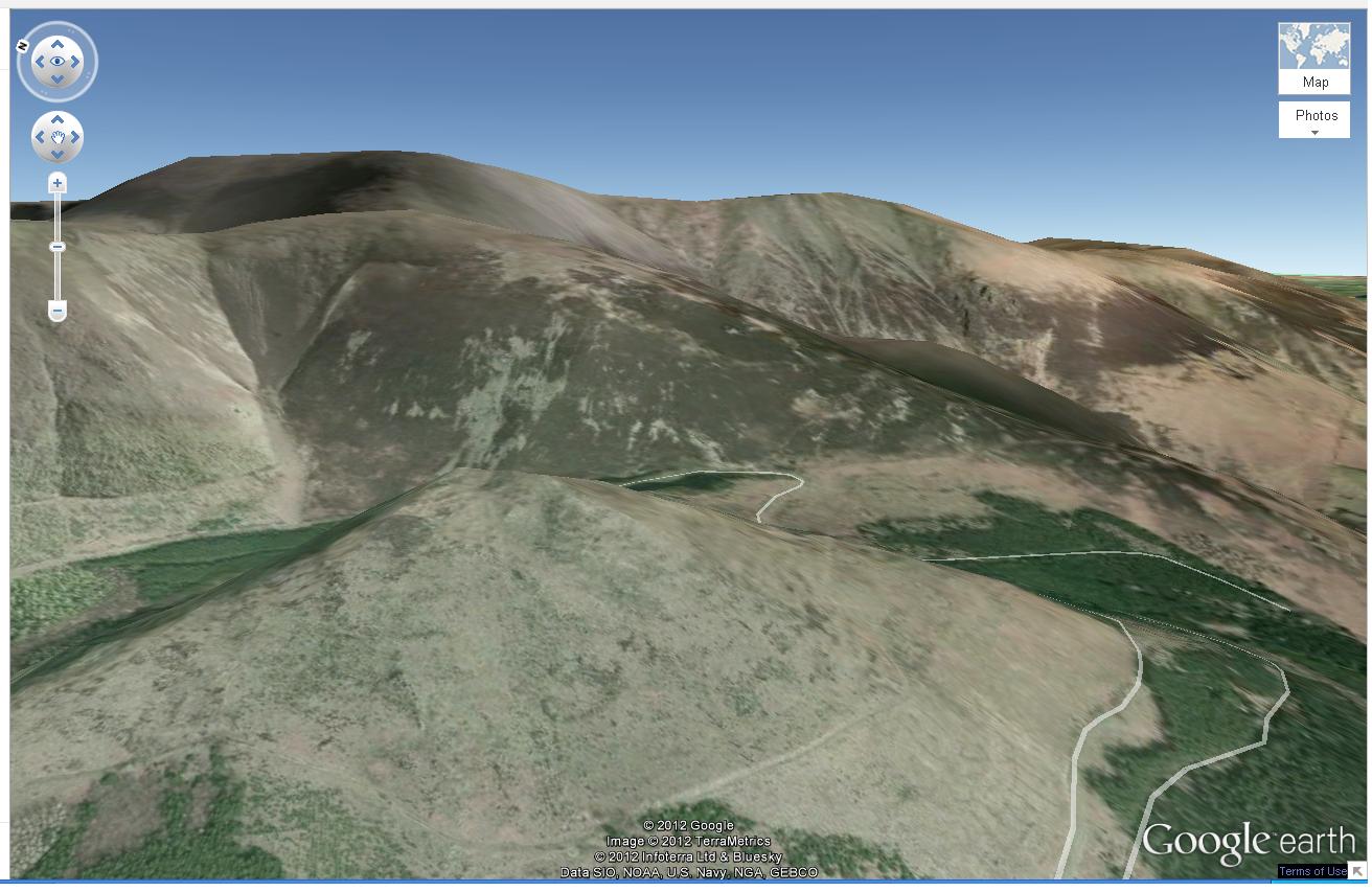
Dear slowcoach and Calchfaen, Thanks for your help; I'd agree that this looks like the Google Earth image of Skiddaw. I will pass this one on to my colleagues at English Heritage to be reclassified. Brian Wilkinson Britain from Above Activity Officer (Scotland) |
Brian Wilkinson |
Wednesday 29th of August 2012 02:54:52 PM |
I thought since the image reference begins with S it would be from Scotland, but this might an exception. google earth for Skiddaw does seem to match this photo, so I'd agree with Calchfaen. |
slowcoach |
Saturday 14th of July 2012 06:20:06 PM |
Gable Gill (on the left) rises above the Thornthwaite Forest in the valley at the foot of the image. Little Man (865m)is topped by cloud towards the right, Skiddaw summit (931m) on the left enjoys a little more cloud. |
Calchfaen |
Thursday 12th of July 2012 06:23:10 AM |
Not in fact Ben Nevis area but looking northeastwards over Dodd to Carl Side, a southwestern spur of Skiddaw in the Lake District. |
Calchfaen |
Thursday 12th of July 2012 06:20:24 AM |
looks like ben nevis fron north east over meal an t'suidhe |
Allan |
Wednesday 27th of June 2012 10:55:46 PM |