
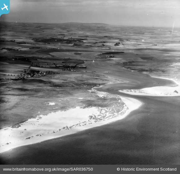
SAR036750 SCOTLAND (1959). Newburgh Foveran, Aberdeenshire, Scotland. An oblique aerial photograph taken facing North/West.
© Copyright OpenStreetMap contributors and licensed by the OpenStreetMap Foundation. 2026. Cartography is licensed as CC BY-SA.
Nearby Images (2)
SAR036750

SAR036751

Details
| Title | [SAR036750] Newburgh Foveran, Aberdeenshire, Scotland. An oblique aerial photograph taken facing North/West. |
| Reference | SAR036750 |
| Date | 1959 |
| Link | NRHE Collection item 1438671 |
| Place name | |
| Parish | FOVERAN |
| District | GORDON |
| Country | SCOTLAND |
| Easting / Northing | 399900, 825200 |
| Longitude / Latitude | -2.0016604773762, 57.317566809676 |
| National Grid Reference | NJ999252 |
Pins

redmist |
Tuesday 25th of October 2022 09:09:34 PM | |
|
redmist |
Tuesday 25th of October 2022 09:05:21 PM | |
|
redmist |
Tuesday 25th of October 2022 09:04:44 PM | |
|
redmist |
Tuesday 25th of October 2022 09:03:57 PM | |
|
redmist |
Tuesday 25th of October 2022 08:40:56 PM | |
|
redmist |
Tuesday 25th of October 2022 08:37:15 PM |