
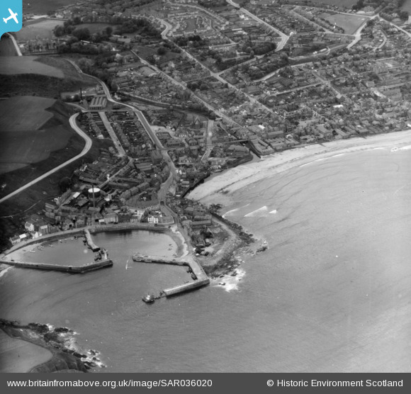
SAR036020 SCOTLAND (1959). General View Dunnottar, Kincardineshire, Scotland. An oblique aerial photograph taken facing North/West.
© Copyright OpenStreetMap contributors and licensed by the OpenStreetMap Foundation. 2026. Cartography is licensed as CC BY-SA.
Nearby Images (4)
SAR036019

SAR036020

SPW040486

SPW040485

Details
| Title | [SAR036020] General View Dunnottar, Kincardineshire, Scotland. An oblique aerial photograph taken facing North/West. |
| Reference | SAR036020 |
| Date | 1959 |
| Link | NRHE Collection item 1438658 |
| Place name | |
| Parish | FETTERESSO |
| District | KINCARDINE AND DEESIDE |
| Country | SCOTLAND |
| Easting / Northing | 387290, 786000 |
| Longitude / Latitude | -2.2090509189935, 56.965215728761 |
| National Grid Reference | NO873860 |
Pins
Be the first to add a comment to this image!
User Comment Contributions
A misleading image title, as Dunnottar (and its ruined castle) is well out of frame to the south. This is a general view of the harbour, beach and town of Stonehaven. |

ewnmcg |
Monday 6th of October 2014 11:05:33 PM |