
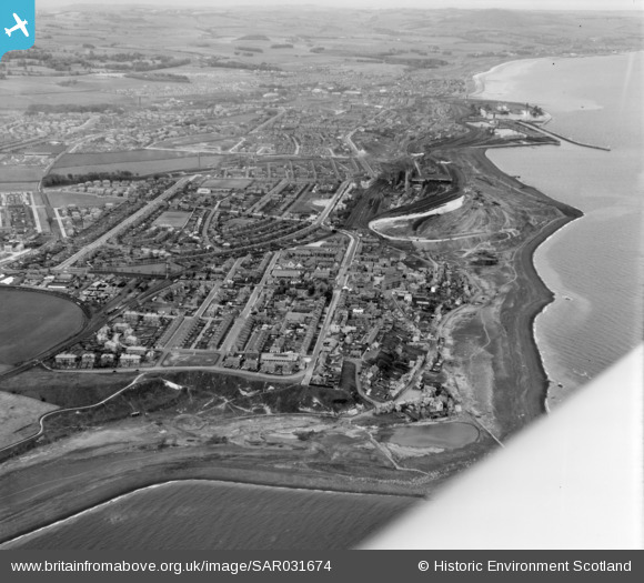
SAR031674 SCOTLAND (1958). Buckhaven, Fife, Scotland. An oblique aerial photograph taken facing north.
© Copyright OpenStreetMap contributors and licensed by the OpenStreetMap Foundation. 2026. Cartography is licensed as CC BY-SA.
Nearby Images (2)
SAR031674

SAR031675

Details
| Title | [SAR031674] Buckhaven, Fife, Scotland. An oblique aerial photograph taken facing north. |
| Reference | SAR031674 |
| Date | 1958 |
| Link | NRHE Collection item 1438565 |
| Place name | |
| Parish | SCOONIE (KIRKCALDY) |
| District | KIRKCALDY |
| Country | SCOTLAND |
| Easting / Northing | 338000, 701000 |
| Longitude / Latitude | -2.9993238013257, 56.197636749354 |
| National Grid Reference | NO380010 |
Pins

redmist |
Sunday 9th of October 2022 10:30:00 PM | |
|
redmist |
Sunday 9th of October 2022 10:23:14 PM | |
|
DTW |
Sunday 4th of July 2021 05:13:55 PM |