
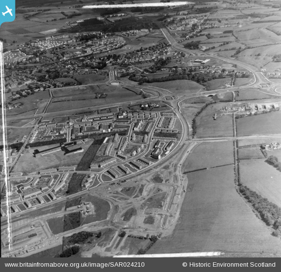
SAR024210 SCOTLAND (1955). East Kilbride Development Corporation, Torrance House East Kilbride, Lanarkshire, Scotland. An oblique aerial photograph taken facing North. This image was marked by AeroPictorial Ltd for photo editing.
© Copyright OpenStreetMap contributors and licensed by the OpenStreetMap Foundation. 2026. Cartography is licensed as CC BY-SA.
Nearby Images (14)
SAR024209

SAR024210

SAR024211

SAR024212

SAR024213

SAR027731

SAR027732

SAR016605

SAR016606

SAR016607

SAR016608

SAR016611

SAR023757

SAW022901

Details
| Title | [SAR024210] East Kilbride Development Corporation, Torrance House East Kilbride, Lanarkshire, Scotland. An oblique aerial photograph taken facing North. This image was marked by AeroPictorial Ltd for photo editing. |
| Reference | SAR024210 |
| Date | 1955 |
| Link | NRHE Collection item 1438446 |
| Place name | |
| Parish | EAST KILBRIDE (SOUTH LANARKSHIRE) |
| District | EAST KILBRIDE |
| Country | SCOTLAND |
| Easting / Northing | 263630, 654110 |
| Longitude / Latitude | -4.1735602980276, 55.761112210556 |
| National Grid Reference | NS636541 |
Pins

DavidKernohan |
Tuesday 7th of January 2020 03:13:37 PM | |
|
Effenbee |
Wednesday 10th of September 2014 11:20:14 PM |