
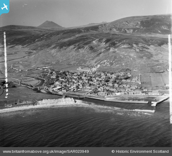
SAR023949 SCOTLAND (1955). Helmsdale Kildonan, Sutherland, Scotland. An oblique aerial photograph taken facing North. This image was marked by AeroPictorial Ltd for photo editing.
© Copyright OpenStreetMap contributors and licensed by the OpenStreetMap Foundation. 2026. Cartography is licensed as CC BY-SA.
Nearby Images (2)
SAR023948

SAR023949

Details
| Title | [SAR023949] Helmsdale Kildonan, Sutherland, Scotland. An oblique aerial photograph taken facing North. This image was marked by AeroPictorial Ltd for photo editing. |
| Reference | SAR023949 |
| Date | 1955 |
| Link | NRHE Collection item 1438434 |
| Place name | |
| Parish | KILDONAN |
| District | SUTHERLAND |
| Country | SCOTLAND |
| Easting / Northing | 302880, 915370 |
| Longitude / Latitude | -3.6486982765505, 58.116928423053 |
| National Grid Reference | ND029154 |
Pins

Andrew Stainer |
Friday 5th of March 2021 02:32:37 PM | |
|
AirSpotterJones |
Friday 5th of April 2019 05:40:23 PM | |
|
AirSpotterJones |
Friday 5th of April 2019 05:35:44 PM | |
|
kipacala |
Wednesday 31st of January 2018 11:23:07 AM | |
|
kipacala |
Wednesday 31st of January 2018 11:22:25 AM | |
|
kipacala |
Wednesday 31st of January 2018 11:21:43 AM | |
|
The Laird |
Thursday 11th of February 2016 02:37:39 PM | |
|
The Laird |
Thursday 11th of February 2016 02:36:52 PM | |
|
The Laird |
Thursday 11th of February 2016 02:36:06 PM | |
|
The Laird |
Thursday 11th of February 2016 02:33:15 PM |