
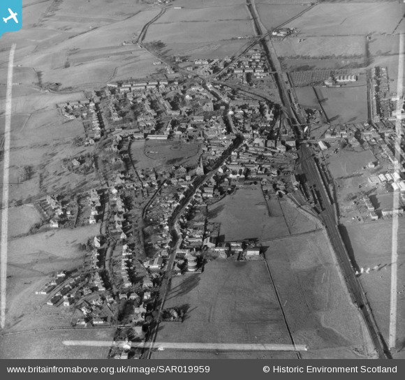
SAR019959 SCOTLAND (1953). General View Dryfesdale, Dumfries-Shire, Scotland. An oblique aerial photograph taken facing North/West. This image was marked by AeroPictorial Ltd for photo editing.
© Copyright OpenStreetMap contributors and licensed by the OpenStreetMap Foundation. 2026. Cartography is licensed as CC BY-SA.
Nearby Images (4)
SAR019959

SPW029217

SPW029218

SPW029216

Details
| Title | [SAR019959] General View Dryfesdale, Dumfries-Shire, Scotland. An oblique aerial photograph taken facing North/West. This image was marked by AeroPictorial Ltd for photo editing. |
| Reference | SAR019959 |
| Date | 1953 |
| Link | NRHE Collection item 1438212 |
| Place name | |
| Parish | DRYFESDALE |
| District | ANNANDALE AND ESKDALE |
| Country | SCOTLAND |
| Easting / Northing | 313600, 581600 |
| Longitude / Latitude | -3.3549249818354, 55.121184669308 |
| National Grid Reference | NY136816 |
Pins
 |

Billy Turner |
Wednesday 18th of November 2015 05:07:04 PM |
 |
Billy Turner |
Wednesday 18th of November 2015 04:37:09 PM |
|
Billy Turner |
Wednesday 18th of November 2015 03:59:54 PM |
