
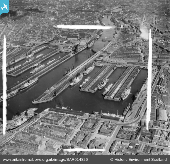
SAR014826 SCOTLAND (1951). Queen's and Prince's Docks looking East Glasgow, Lanarkshire, Scotland. An oblique aerial photograph taken facing East. This image was marked by AeroPictorial Ltd for photo editing.
© Copyright OpenStreetMap contributors and licensed by the OpenStreetMap Foundation. 2026. Cartography is licensed as CC BY-SA.
Nearby Images (18)
SAR008788

SAR008790

SAR014705

SAR014707

SAR014709

SAR014713

SAR014774

SAR014826

SAR014832

SAR015079

SPW020708

SAW017939

SPW045884

SAW017940

SAW017941

SPW045891

SPW022182

SPW022179

Details
| Title | [SAR014826] Queen's and Prince's Docks looking East Glasgow, Lanarkshire, Scotland. An oblique aerial photograph taken facing East. This image was marked by AeroPictorial Ltd for photo editing. |
| Reference | SAR014826 |
| Date | 1951 |
| Link | NRHE Collection item 1437904 |
| Place name | |
| Parish | GLASGOW (CITY OF GLASGOW) |
| District | CITY OF GLASGOW |
| Country | SCOTLAND |
| Easting / Northing | 256790, 665430 |
| Longitude / Latitude | -4.2884447535955, 55.860777640235 |
| National Grid Reference | NS568654 |
Pins
Be the first to add a comment to this image!