
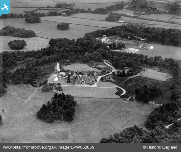
EPW062859 ENGLAND (1939). Hill Bark, Frankby, 1939
© Copyright OpenStreetMap contributors and licensed by the OpenStreetMap Foundation. 2026. Cartography is licensed as CC BY-SA.
Nearby Images (6)
EPW062859

EPW062861

EPW062860

EPW062862

EPW062863

EPW062864

Details
| Title | [EPW062859] Hill Bark, Frankby, 1939 |
| Reference | EPW062859 |
| Date | 31-August-1939 |
| Link | |
| Place name | FRANKBY |
| Parish | |
| District | |
| Country | ENGLAND |
| Easting / Northing | 324410, 385763 |
| Longitude / Latitude | -3.136035828851, 53.363061503689 |
| National Grid Reference | SJ244858 |
Pins

Mark |
Wednesday 14th of January 2015 11:38:09 PM | |
|
Mark |
Wednesday 14th of January 2015 11:35:12 PM | |
|
Mark |
Wednesday 14th of January 2015 11:30:43 PM | |
|
Mark |
Wednesday 14th of January 2015 11:30:42 PM | |
|
Mark |
Wednesday 14th of January 2015 11:28:26 PM | |
|
totoro |
Thursday 19th of December 2013 09:02:47 PM | |
|
Pete65 |
Monday 14th of October 2013 11:54:33 AM | |
|
Pete65 |
Monday 14th of October 2013 11:54:04 AM |