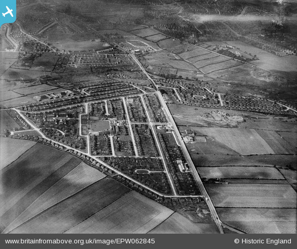
EPW062845 ENGLAND (1939). Frecheville, Sheffield, from the south-east, 1939
© Copyright OpenStreetMap contributors and licensed by the OpenStreetMap Foundation. 2026. Cartography is licensed as CC BY-SA.
Nearby Images (5)
Details
| Title | [EPW062845] Frecheville, Sheffield, from the south-east, 1939 |
| Reference | EPW062845 |
| Date | 30-August-1939 |
| Link | |
| Place name | SHEFFIELD |
| Parish | |
| District | |
| Country | ENGLAND |
| Easting / Northing | 440058, 383483 |
| Longitude / Latitude | -1.3982137698579, 53.346453887785 |
| National Grid Reference | SK401835 |
Pins

Yorkie |
Tuesday 22nd of October 2013 12:06:17 AM |


![[EPW062845] Frecheville, Sheffield, from the south-east, 1939](http://britainfromabove.org.uk/sites/all/libraries/aerofilms-images/public/100x100/EPW/062/EPW062845.jpg)
![[EPW062847] Frecheville, Sheffield, from the south-east, 1939](http://britainfromabove.org.uk/sites/all/libraries/aerofilms-images/public/100x100/EPW/062/EPW062847.jpg)
![[EPW062832] Frecheville, Sheffield, from the south, 1939](http://britainfromabove.org.uk/sites/all/libraries/aerofilms-images/public/100x100/EPW/062/EPW062832.jpg)
![[EPW062834] Frecheville, Sheffield, 1939](http://britainfromabove.org.uk/sites/all/libraries/aerofilms-images/public/100x100/EPW/062/EPW062834.jpg)
![[EPW062833] Frecheville, Sheffield, from the south, 1939](http://britainfromabove.org.uk/sites/all/libraries/aerofilms-images/public/100x100/EPW/062/EPW062833.jpg)