
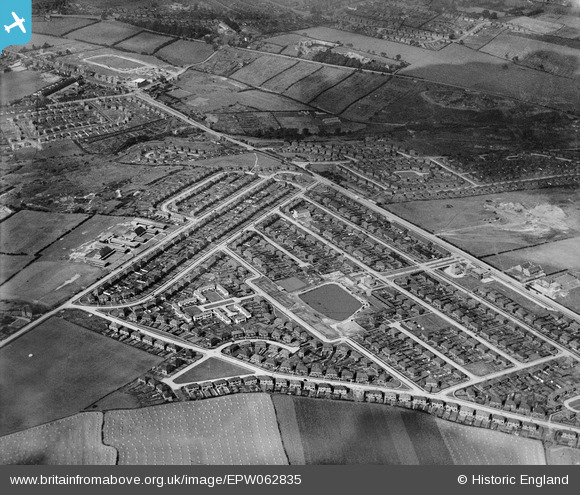
EPW062835 ENGLAND (1939). Frecheville, Sheffield, 1939
© Copyright OpenStreetMap contributors and licensed by the OpenStreetMap Foundation. 2026. Cartography is licensed as CC BY-SA.
Nearby Images (2)
EPW062835

EPW062834

Details
| Title | [EPW062835] Frecheville, Sheffield, 1939 |
| Reference | EPW062835 |
| Date | 30-August-1939 |
| Link | |
| Place name | SHEFFIELD |
| Parish | |
| District | |
| Country | ENGLAND |
| Easting / Northing | 439710, 383774 |
| Longitude / Latitude | -1.4034048987493, 53.349095991877 |
| National Grid Reference | SK397838 |
Pins

intitot |
Saturday 29th of January 2022 10:02:53 PM | |
|
hodges1120 |
Monday 2nd of June 2014 03:47:33 PM | |
|
Yorkie |
Tuesday 22nd of October 2013 12:10:11 AM |