
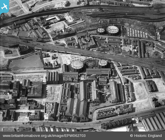
EPW062703 ENGLAND (1939). Rochdale Road Gas Works, Manchester, 1939
© Copyright OpenStreetMap contributors and licensed by the OpenStreetMap Foundation. 2026. Cartography is licensed as CC BY-SA.
Nearby Images (8)
EPW062703

EPW062704

EPW062702

EPW062692

EPW062701

EPW062690

EPW062691

EAW023395

Details
| Title | [EPW062703] Rochdale Road Gas Works, Manchester, 1939 |
| Reference | EPW062703 |
| Date | 16-August-1939 |
| Link | |
| Place name | MANCHESTER |
| Parish | |
| District | |
| Country | ENGLAND |
| Easting / Northing | 384624, 399271 |
| Longitude / Latitude | -2.231768091306, 53.489673949875 |
| National Grid Reference | SJ846993 |
Pins

Kentishman |
Saturday 11th of October 2025 09:49:16 AM | |
|
Kentishman |
Saturday 11th of October 2025 09:46:36 AM | |
|
Kentishman |
Saturday 11th of October 2025 09:42:16 AM | |
|
Paul Williams |
Saturday 16th of March 2024 11:11:33 PM | |
|
designking |
Friday 11th of June 2021 07:53:42 PM | |
|
designking |
Friday 11th of June 2021 07:53:03 PM | |
|
designking |
Friday 11th of June 2021 07:52:26 PM | |
|
designking |
Friday 11th of June 2021 07:51:54 PM | |
|
designking |
Friday 11th of June 2021 07:51:14 PM |