
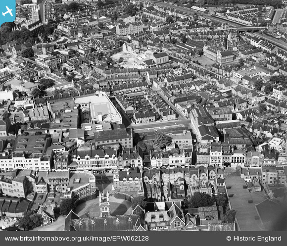
EPW062128 ENGLAND (1939). Keeley Road and environs, Croydon, 1939
© Copyright OpenStreetMap contributors and licensed by the OpenStreetMap Foundation. 2026. Cartography is licensed as CC BY-SA.
Nearby Images (9)
EPW062128

EPW062129

EPW062131

EPW062130

EPW062126

EPW062127

EPW056622

EPW052795

EPW021425

Details
| Title | [EPW062128] Keeley Road and environs, Croydon, 1939 |
| Reference | EPW062128 |
| Date | 2-July-1939 |
| Link | |
| Place name | CROYDON |
| Parish | |
| District | |
| Country | ENGLAND |
| Easting / Northing | 532162, 165698 |
| Longitude / Latitude | -0.10095234530144, 51.374437240568 |
| National Grid Reference | TQ322657 |
Pins
Be the first to add a comment to this image!