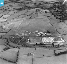
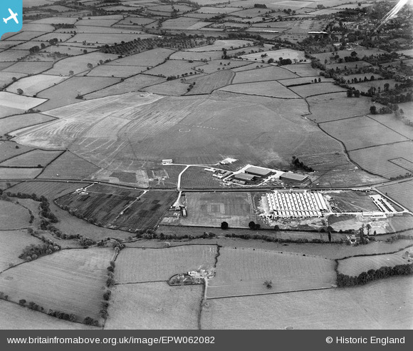
EPW062082 ENGLAND (1939). Staverton Aerodrome and the Rotol Ltd Works, Churchdown, 1939
© Copyright OpenStreetMap contributors and licensed by the OpenStreetMap Foundation. 2026. Cartography is licensed as CC BY-SA.
Nearby Images (2)
EPW062082

EPW062081

Details
| Title | [EPW062082] Staverton Aerodrome and the Rotol Ltd Works, Churchdown, 1939 |
| Reference | EPW062082 |
| Date | 30-June-1939 |
| Link | |
| Place name | CHURCHDOWN |
| Parish | CHURCHDOWN |
| District | |
| Country | ENGLAND |
| Easting / Northing | 388381, 222023 |
| Longitude / Latitude | -2.168874471795, 51.896196584918 |
| National Grid Reference | SO884220 |
Pins

Matt Aldred edob.mattaldred.com |
Monday 11th of March 2024 05:40:03 PM | |

Jed |
Sunday 12th of January 2020 11:38:29 PM | |
|
Jed |
Wednesday 21st of May 2014 10:35:49 PM | |
|
Toby Clempson |
Sunday 2nd of March 2014 08:26:04 AM | |
|
Toby Clempson |
Sunday 2nd of March 2014 08:25:06 AM | |
|
Toby Clempson |
Sunday 2nd of March 2014 08:17:57 AM | |
|
Toby Clempson |
Friday 1st of November 2013 02:03:53 PM | |
|
Toby Clempson |
Friday 1st of November 2013 02:03:25 PM | |
|
Richcl |
Friday 30th of August 2013 05:52:57 PM | |
It is now, but at the time this was taken the road was the A40. |
Toby Clempson |
Friday 1st of November 2013 01:54:19 PM |
|
Richcl |
Friday 30th of August 2013 05:51:48 PM |