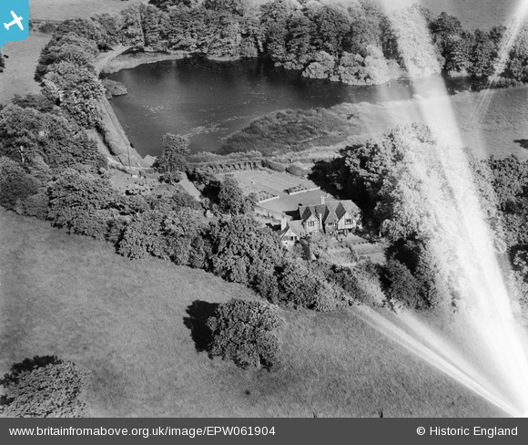
EPW061904 ENGLAND (1939). A private residence by the Ifield Mill Pond, Crawley, 1939. This image has been affected by flare.
© Copyright OpenStreetMap contributors and licensed by the OpenStreetMap Foundation. 2024. Cartography is licensed as CC BY-SA.
Details
| Title | [EPW061904] A private residence by the Ifield Mill Pond, Crawley, 1939. This image has been affected by flare. |
| Reference | EPW061904 |
| Date | June-1939 |
| Link | |
| Place name | CRAWLEY |
| Parish | |
| District | |
| Country | ENGLAND |
| Easting / Northing | 524394, 136426 |
| Longitude / Latitude | -0.22268430222511, 51.113079994074 |
| National Grid Reference | TQ244364 |
Pins
Be the first to add a comment to this image!


![[EPW061904] A private residence by the Ifield Mill Pond, Crawley, 1939. This image has been affected by flare.](http://britainfromabove.org.uk/sites/all/libraries/aerofilms-images/public/100x100/EPW/061/EPW061904.jpg)
![[EPW061903] A private residence by the Ifield Mill Pond, Crawley, 1939](http://britainfromabove.org.uk/sites/all/libraries/aerofilms-images/public/100x100/EPW/061/EPW061903.jpg)
![[EPW061905] A private residence by the Ifield Mill Pond, Crawley, 1939](http://britainfromabove.org.uk/sites/all/libraries/aerofilms-images/public/100x100/EPW/061/EPW061905.jpg)
![[EPW061902] A private residence by the Ifield Mill Pond, Crawley, 1939](http://britainfromabove.org.uk/sites/all/libraries/aerofilms-images/public/100x100/EPW/061/EPW061902.jpg)