
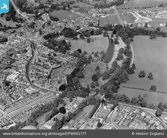
EPW061777 ENGLAND (1939). Abbey Grounds and environs, Cirencester, 1939
© Copyright OpenStreetMap contributors and licensed by the OpenStreetMap Foundation. 2026. Cartography is licensed as CC BY-SA.
Nearby Images (7)
EPW061777

EPW061778

EPW061779

EPW061785

EPW061782

EPW022415

EPW022417

Details
| Title | [EPW061777] Abbey Grounds and environs, Cirencester, 1939 |
| Reference | EPW061777 |
| Date | 8-June-1939 |
| Link | |
| Place name | CIRENCESTER |
| Parish | CIRENCESTER |
| District | |
| Country | ENGLAND |
| Easting / Northing | 402624, 202155 |
| Longitude / Latitude | -1.9620122845536, 51.717657830455 |
| National Grid Reference | SP026022 |
Pins
Be the first to add a comment to this image!