
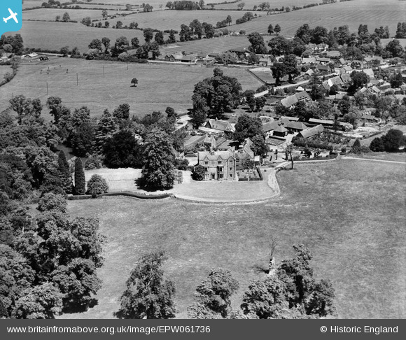
EPW061736 ENGLAND (1939). The Grange, Radway, 1939
© Copyright OpenStreetMap contributors and licensed by the OpenStreetMap Foundation. 2026. Cartography is licensed as CC BY-SA.
Nearby Images (4)
EPW061736

EPW061738

EPW061737

EPW061740

Details
| Title | [EPW061736] The Grange, Radway, 1939 |
| Reference | EPW061736 |
| Date | 10-June-1939 |
| Link | |
| Place name | RADWAY |
| Parish | RADWAY |
| District | |
| Country | ENGLAND |
| Easting / Northing | 436981, 247991 |
| Longitude / Latitude | -1.4597122395328, 52.12857713218 |
| National Grid Reference | SP370480 |
Pins
Be the first to add a comment to this image!