
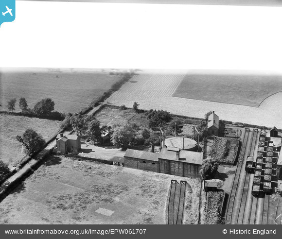
EPW061707 ENGLAND (1939). The Gas Works, Craven Arms, 1939. This image has been affected by flare.
© Copyright OpenStreetMap contributors and licensed by the OpenStreetMap Foundation. 2026. Cartography is licensed as CC BY-SA.
Nearby Images (5)
EPW061707

EPW061706

EPW061708

EPW061704

EPW061705

Details
| Title | [EPW061707] The Gas Works, Craven Arms, 1939. This image has been affected by flare. |
| Reference | EPW061707 |
| Date | 10-June-1939 |
| Link | |
| Place name | CRAVEN ARMS |
| Parish | CRAVEN ARMS |
| District | |
| Country | ENGLAND |
| Easting / Northing | 343007, 283142 |
| Longitude / Latitude | -2.8385784152938, 52.442895111297 |
| National Grid Reference | SO430831 |
Pins

Andrew Bennett |
Tuesday 29th of October 2013 11:15:49 PM |