
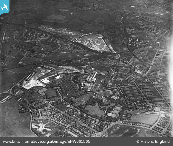
EPW061565 ENGLAND (1939). The Gerard's Bridge Plate Glass Works, Victoria Park and Sand Lodge, St Helens, 1939
© Copyright OpenStreetMap contributors and licensed by the OpenStreetMap Foundation. 2026. Cartography is licensed as CC BY-SA.
Nearby Images (18)
EPW061565

EPW061564

EAW012393

EAW012387

EPW009318

EPW061568

EAW012390

EPW061563

EPW009312

EAW013766

EAW013757

EPW061562

EPW061567

EAW013754

EAW013768

EAW012389

EPW061569

EAW013770

Details
| Title | [EPW061565] The Gerard's Bridge Plate Glass Works, Victoria Park and Sand Lodge, St Helens, 1939 |
| Reference | EPW061565 |
| Date | 4-June-1939 |
| Link | |
| Place name | ST HELENS |
| Parish | |
| District | |
| Country | ENGLAND |
| Easting / Northing | 351257, 396601 |
| Longitude / Latitude | -2.7342768240608, 53.46364068954 |
| National Grid Reference | SJ513966 |
Pins

pauloyick |
Tuesday 7th of January 2014 07:30:50 PM |