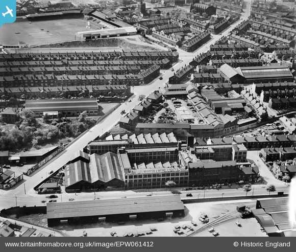
EPW061412 ENGLAND (1939). Charlotte Road and the Mappin and Webb Ltd Royal Works on Queens Road, Sheffield, 1939
    © Copyright OpenStreetMap contributors and licensed by the OpenStreetMap Foundation. 2025. Cartography is licensed as CC BY-SA.
  
Nearby Images (5)
Details
| Title | [EPW061412] Charlotte Road and the Mappin and Webb Ltd Royal Works on Queens Road, Sheffield, 1939 | 
| Reference | EPW061412 | 
| Date | 2-July-1939 | 
| Link | |
| Place name | SHEFFIELD | 
| Parish | |
| District | |
| Country | ENGLAND | 
| Easting / Northing | 435617, 386074 | 
| Longitude / Latitude | -1.464635132157, 53.370062871558 | 
| National Grid Reference | SK356861 | 
Pins
|   Duck648 | Friday 3rd of April 2020 09:51:03 PM | 
 
             
  ![[EPW061412] Charlotte Road and the Mappin and Webb Ltd Royal Works on Queens Road, Sheffield, 1939](http://britainfromabove.org.uk/sites/all/libraries/aerofilms-images/public/100x100/EPW/061/EPW061412.jpg) 
 ![[EPW061409] The Mappin and Webb Ltd Royal Works on Queens Road, Sheffield, 1939](http://britainfromabove.org.uk/sites/all/libraries/aerofilms-images/public/100x100/EPW/061/EPW061409.jpg) 
 ![[EPW061411] Charlotte Road and the Mappin and Webb Ltd Royal Works on Queens Road, Sheffield, 1939](http://britainfromabove.org.uk/sites/all/libraries/aerofilms-images/public/100x100/EPW/061/EPW061411.jpg) 
 ![[EPW061410] The Mappin and Webb Ltd Royal Works on Queens Road, Sheffield, 1939](http://britainfromabove.org.uk/sites/all/libraries/aerofilms-images/public/100x100/EPW/061/EPW061410.jpg) 
 ![[EPW061408] The Mappin and Webb Ltd Royal Works on Queens Road, Sheffield, 1939](http://britainfromabove.org.uk/sites/all/libraries/aerofilms-images/public/100x100/EPW/061/EPW061408.jpg)