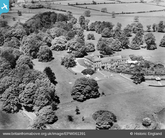
EPW061391 ENGLAND (1939). Southill House, Cranmore, 1939
© Copyright OpenStreetMap contributors and licensed by the OpenStreetMap Foundation. 2025. Cartography is licensed as CC BY-SA.
Nearby Images (5)
Details
| Title | [EPW061391] Southill House, Cranmore, 1939 |
| Reference | EPW061391 |
| Date | 4-June-1939 |
| Link | |
| Place name | CRANMORE |
| Parish | CRANMORE |
| District | |
| Country | ENGLAND |
| Easting / Northing | 367149, 142627 |
| Longitude / Latitude | -2.4700470712904, 51.18140924015 |
| National Grid Reference | ST671426 |
Pins
Be the first to add a comment to this image!
User Comment Contributions
Southill House, Cranmore, 28/03/2016 |
 Class31 |
Friday 1st of April 2016 07:12:22 AM |
Southill House, Cranmore, 16/07/2014 |
 Class31 |
Wednesday 16th of July 2014 05:14:51 PM |
Southill House, Cranmore, 16/07/2014 |
 Class31 |
Wednesday 16th of July 2014 05:13:13 PM |
Southill House, Cranmore, 16/07/2014 |
 Class31 |
Wednesday 16th of July 2014 05:12:14 PM |


![[EPW061391] Southill House, Cranmore, 1939](http://britainfromabove.org.uk/sites/all/libraries/aerofilms-images/public/100x100/EPW/061/EPW061391.jpg)
![[EPW061394] Southill House, Cranmore, 1939](http://britainfromabove.org.uk/sites/all/libraries/aerofilms-images/public/100x100/EPW/061/EPW061394.jpg)
![[EPW061392] Southill House, Cranmore, 1939](http://britainfromabove.org.uk/sites/all/libraries/aerofilms-images/public/100x100/EPW/061/EPW061392.jpg)
![[EPW061393] Southill House, Cranmore, 1939](http://britainfromabove.org.uk/sites/all/libraries/aerofilms-images/public/100x100/EPW/061/EPW061393.jpg)
![[EPW061395] Southill House, Cranmore, 1939](http://britainfromabove.org.uk/sites/all/libraries/aerofilms-images/public/100x100/EPW/061/EPW061395.jpg)