
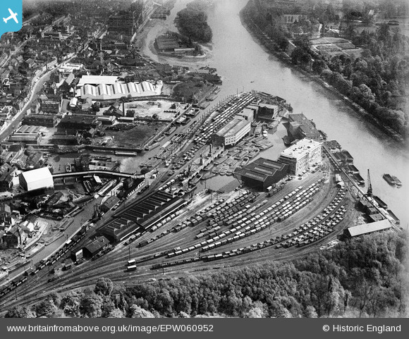
EPW060952 ENGLAND (1939). Brentford Dock, Brentford, 1939
© Copyright OpenStreetMap contributors and licensed by the OpenStreetMap Foundation. 2026. Cartography is licensed as CC BY-SA.
Nearby Images (4)
EPW060952

EPW001670

EPW060459

EPW057985

Details
| Title | [EPW060952] Brentford Dock, Brentford, 1939 |
| Reference | EPW060952 |
| Date | 12-May-1939 |
| Link | |
| Place name | BRENTFORD |
| Parish | |
| District | |
| Country | ENGLAND |
| Easting / Northing | 517913, 177248 |
| Longitude / Latitude | -0.30174998262839, 51.481395146349 |
| National Grid Reference | TQ179772 |
Pins

Leslie B |
Wednesday 24th of August 2022 09:27:26 PM | |
|
Leslie B |
Wednesday 24th of August 2022 09:17:09 PM |