
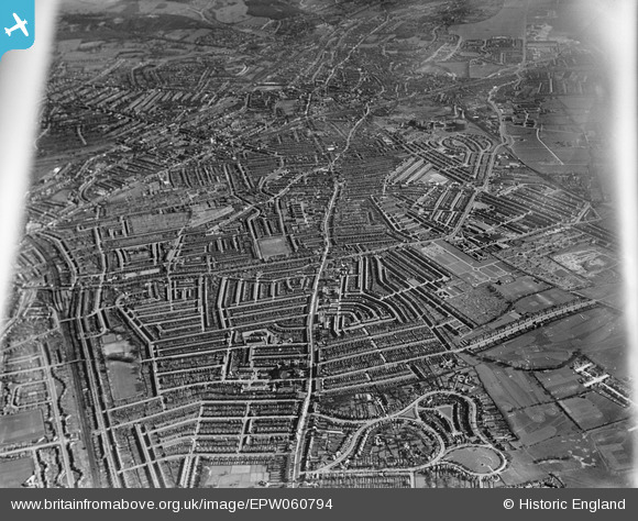
EPW060794 ENGLAND (1939). London Road from Norbury to Broad Green with Croydon in the distance, Thornton Heath, from the north-west, 1939
© Copyright OpenStreetMap contributors and licensed by the OpenStreetMap Foundation. 2026. Cartography is licensed as CC BY-SA.
Nearby Images (2)
EPW060794

EPW052802

Details
| Title | [EPW060794] London Road from Norbury to Broad Green with Croydon in the distance, Thornton Heath, from the north-west, 1939 |
| Reference | EPW060794 |
| Date | 12-April-1939 |
| Link | |
| Place name | THORNTON HEATH |
| Parish | |
| District | |
| Country | ENGLAND |
| Easting / Northing | 531180, 168108 |
| Longitude / Latitude | -0.11416415556268, 51.396325637669 |
| National Grid Reference | TQ312681 |
Pins

BarbaraB |
Monday 30th of December 2019 03:33:38 AM | |
|
BarbaraB |
Saturday 28th of December 2019 05:08:31 AM | |
|
RBMcN |
Thursday 3rd of September 2015 10:55:24 AM | |
|
Johnners |
Tuesday 2nd of July 2013 11:46:56 AM | |
|
Johnners |
Tuesday 2nd of July 2013 11:46:09 AM | |
|
Johnners |
Tuesday 2nd of July 2013 11:45:28 AM | |
|
Johnners |
Tuesday 2nd of July 2013 11:44:30 AM | |
|
S Hope |
Friday 14th of June 2013 06:47:01 PM | |
|
S Hope |
Friday 14th of June 2013 06:46:06 PM | |
|
S Hope |
Friday 14th of June 2013 06:44:51 PM | |
|
S Hope |
Friday 14th of June 2013 06:44:18 PM | |
|
S Hope |
Friday 14th of June 2013 06:42:43 PM | |
|
S Hope |
Friday 14th of June 2013 06:41:10 PM |