
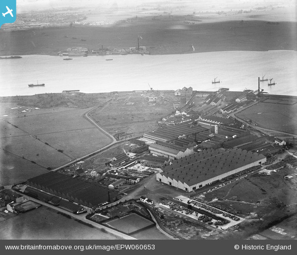
EPW060653 ENGLAND (1939). Callender's Cable and Construction Company Ltd Works and the River Thames, Erith, from the west, 1939
© Copyright OpenStreetMap contributors and licensed by the OpenStreetMap Foundation. 2026. Cartography is licensed as CC BY-SA.
Nearby Images (48)
EPW060653

EAW048351

EAW048359

EPW062292

EPW060652

EAW048350

EPW060661

EPW037311

EAW048345

EPW060654

EPW060656

EPW060712

EPW060657

EAW014571

EPW037908

EPW060715

EAW048347

EAW048346

EPW060714

EPW060713

EPW060658

EAW048358

EPW060716

EAW014567

EPW060665

EPW060718

EPW060717

EPW060663

EPW060659

EAW048348

EAW048357

EPW060655

EAW014572

EPW060662

EPW037308

EAW048349

EAW048356

EAW048352

EAW014566

EAW048355

EPW062289

EPW060664

EPW060660

EPW037305

EPW037904

EPW037312

EPW037304

EPW037306

Details
| Title | [EPW060653] Callender's Cable and Construction Company Ltd Works and the River Thames, Erith, from the west, 1939 |
| Reference | EPW060653 |
| Date | March-1939 |
| Link | |
| Place name | ERITH |
| Parish | |
| District | |
| Country | ENGLAND |
| Easting / Northing | 550381, 179660 |
| Longitude / Latitude | 0.16657955844302, 51.495368924015 |
| National Grid Reference | TQ504797 |
Pins
Be the first to add a comment to this image!