
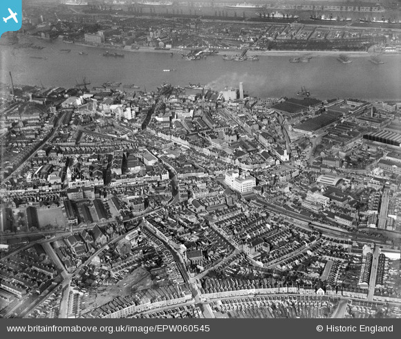
EPW060545 ENGLAND (1939). The area between Crescent Road and the River Thames, Woolwich, 1939
© Copyright OpenStreetMap contributors and licensed by the OpenStreetMap Foundation. 2026. Cartography is licensed as CC BY-SA.
Nearby Images (5)
EPW060545

EAW014126

EAW014132

EAW014127

EAW014129

Details
| Title | [EPW060545] The area between Crescent Road and the River Thames, Woolwich, 1939 |
| Reference | EPW060545 |
| Date | 28-February-1939 |
| Link | |
| Place name | WOOLWICH |
| Parish | |
| District | |
| Country | ENGLAND |
| Easting / Northing | 543551, 178940 |
| Longitude / Latitude | 0.067955587330199, 51.490674391945 |
| National Grid Reference | TQ436789 |
Pins

russellwynn@mail.com |
Friday 13th of October 2023 07:08:30 PM | |
|
ray Glenister |
Saturday 20th of March 2021 07:09:38 AM | |
|
ray Glenister |
Saturday 20th of March 2021 07:05:41 AM | |
|
John W |
Saturday 20th of July 2019 05:46:26 PM | |
|
John W |
Saturday 20th of July 2019 05:45:30 PM | |
|
John W |
Saturday 20th of July 2019 05:44:41 PM | |
|
John W |
Saturday 20th of July 2019 05:43:14 PM | |
|
John W |
Saturday 20th of July 2019 05:42:11 PM | |
|
John W |
Saturday 20th of July 2019 05:41:01 PM | |
|
John W |
Saturday 20th of July 2019 05:39:50 PM | |
|
John W |
Saturday 20th of July 2019 05:39:06 PM | |
|
John W |
Saturday 20th of July 2019 05:37:53 PM | |
|
John W |
Saturday 20th of July 2019 05:36:42 PM | |
|
John W |
Saturday 20th of July 2019 05:36:02 PM | |
|
John W |
Saturday 20th of July 2019 05:33:12 PM | |
|
John W |
Saturday 20th of July 2019 05:32:19 PM | |
|
John W |
Saturday 20th of July 2019 05:31:19 PM | |
|
John W |
Saturday 20th of July 2019 05:30:07 PM | |
|
John W |
Saturday 20th of July 2019 05:28:25 PM | |
|
John W |
Saturday 20th of July 2019 05:27:08 PM | |
|
John W |
Saturday 20th of July 2019 05:25:38 PM | |
|
John W |
Sunday 14th of August 2016 10:29:26 PM | |
|
John W |
Sunday 14th of August 2016 10:22:21 PM | |
|
John W |
Sunday 14th of August 2016 10:21:16 PM |