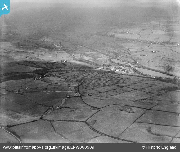
EPW060509 ENGLAND (1939). Poultry Farm at Kenyon Clough and environs, Helmshore, from the west, 1939
    © Copyright OpenStreetMap contributors and licensed by the OpenStreetMap Foundation. 2025. Cartography is licensed as CC BY-SA.
  
Nearby Images (6)
Details
| Title | [EPW060509] Poultry Farm at Kenyon Clough and environs, Helmshore, from the west, 1939 | 
| Reference | EPW060509 | 
| Date | 9-March-1939 | 
| Link | |
| Place name | HELMSHORE | 
| Parish | |
| District | |
| Country | ENGLAND | 
| Easting / Northing | 378406, 420084 | 
| Longitude / Latitude | -2.326933388514, 53.676547497745 | 
| National Grid Reference | SD784201 | 
Pins
|  Kenyon Clough |   Clare Waterfall-Hallam | Tuesday 17th of May 2022 02:09:14 PM | 
|  B6214 Helmshore Road |   wadey | Monday 24th of November 2014 03:27:45 PM | 
 
             
  ![[EPW060509] Poultry Farm at Kenyon Clough and environs, Helmshore, from the west, 1939](http://britainfromabove.org.uk/sites/all/libraries/aerofilms-images/public/100x100/EPW/060/EPW060509.jpg) 
  
                                          ![[EPW060510] Poultry Farm at Kenyon Clough and environs, Helmshore, 1939](http://britainfromabove.org.uk/sites/all/libraries/aerofilms-images/public/100x100/EPW/060/EPW060510.jpg) 
 ![[EPW060504] Poultry Farm at Kenyon Clough, Helmshore, 1939](http://britainfromabove.org.uk/sites/all/libraries/aerofilms-images/public/100x100/EPW/060/EPW060504.jpg) 
 ![[EPW060503] Poultry Farm at Kenyon Clough, Helmshore, 1939](http://britainfromabove.org.uk/sites/all/libraries/aerofilms-images/public/100x100/EPW/060/EPW060503.jpg) 
 ![[EPW060501] Poultry Farm at Kenyon Clough, Helmshore, 1939](http://britainfromabove.org.uk/sites/all/libraries/aerofilms-images/public/100x100/EPW/060/EPW060501.jpg) 
 ![[EPW060505] Poultry Farm at Kenyon Clough, Helmshore, 1939](http://britainfromabove.org.uk/sites/all/libraries/aerofilms-images/public/100x100/EPW/060/EPW060505.jpg)