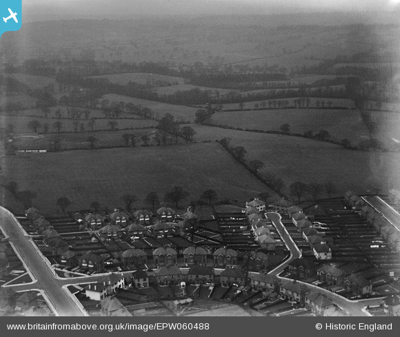
EPW060488 ENGLAND (1939). Pycombe Corner, Rodmell Slope, Cissbury Ring North and environs, Woodside Park, from the south-east, 1939
© Copyright OpenStreetMap contributors and licensed by the OpenStreetMap Foundation. 2025. Cartography is licensed as CC BY-SA.
Details
| Title | [EPW060488] Pycombe Corner, Rodmell Slope, Cissbury Ring North and environs, Woodside Park, from the south-east, 1939 |
| Reference | EPW060488 |
| Date | 9-February-1939 |
| Link | |
| Place name | WOODSIDE PARK |
| Parish | |
| District | |
| Country | ENGLAND |
| Easting / Northing | 524848, 192533 |
| Longitude / Latitude | -0.1964941247568, 51.617288024233 |
| National Grid Reference | TQ248925 |
Pins
Be the first to add a comment to this image!


![[EPW060488] Pycombe Corner, Rodmell Slope, Cissbury Ring North and environs, Woodside Park, from the south-east, 1939](http://britainfromabove.org.uk/sites/all/libraries/aerofilms-images/public/100x100/EPW/060/EPW060488.jpg)
![[EPW060484] Frith Manor School under construction, Lullington Garth and environs, Mill Hill, 1939](http://britainfromabove.org.uk/sites/all/libraries/aerofilms-images/public/100x100/EPW/060/EPW060484.jpg)
![[EPW060482] Lullington Garth, Frith Manor and surrounding countryside, Mill Hill, from the east, 1939](http://britainfromabove.org.uk/sites/all/libraries/aerofilms-images/public/100x100/EPW/060/EPW060482.jpg)
![[EPW060481] Lullington Garth and Cissbury Ring South, Woodside Park, from the south-east, 1939](http://britainfromabove.org.uk/sites/all/libraries/aerofilms-images/public/100x100/EPW/060/EPW060481.jpg)