
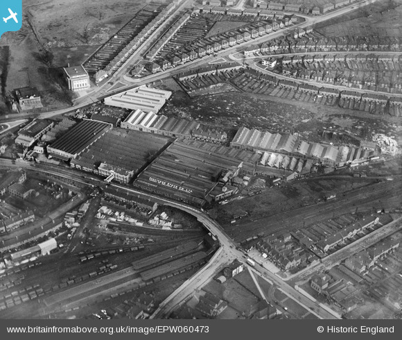
EPW060473 ENGLAND (1939). Station Road, the Parkinson Stove Co Ltd Works and environs, Stechford, 1939
© Copyright OpenStreetMap contributors and licensed by the OpenStreetMap Foundation. 2025. Cartography is licensed as CC BY-SA.
Nearby Images (16)
EPW060473

EPW060478

EPW060472

EPW060474

EPW060477

EPW060476

EPW060523

EPW060479

EPW060524

EPW060527

EPW060529

EPW060528

EPW060530

EPW060525

EPW060475

EPW060526

Details
| Title | [EPW060473] Station Road, the Parkinson Stove Co Ltd Works and environs, Stechford, 1939 |
| Reference | EPW060473 |
| Date | 9-February-1939 |
| Link | |
| Place name | STECHFORD |
| Parish | |
| District | |
| Country | ENGLAND |
| Easting / Northing | 413077, 287565 |
| Longitude / Latitude | -1.8074047424632, 52.485478528127 |
| National Grid Reference | SP131876 |
Pins
Be the first to add a comment to this image!