
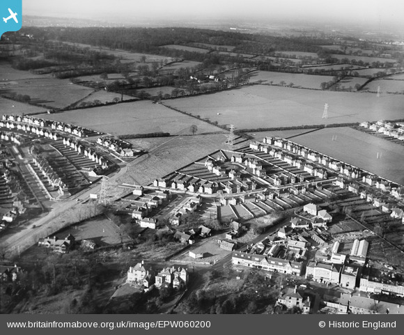
EPW060200 ENGLAND (1938). Broadmead Close and environs, Hatch End, 1938
© Copyright OpenStreetMap contributors and licensed by the OpenStreetMap Foundation. 2026. Cartography is licensed as CC BY-SA.
Nearby Images (2)
EPW060200

 0°
0m
0°
0m
EPW060183
 158°
156m
158°
156m
Details
| Title | [EPW060200] Broadmead Close and environs, Hatch End, 1938 |
| Reference | EPW060200 |
| Date | 30-November-1938 |
| Link | |
| Place name | HATCH END |
| Parish | |
| District | |
| Country | ENGLAND |
| Easting / Northing | 512293, 191254 |
| Longitude / Latitude | -0.37818602349571, 51.608436794594 |
| National Grid Reference | TQ123913 |
Pins
 Broadmead Cl Broadmead Cl |

adelra |
Wednesday 12th of August 2026 10:24:22 AM |